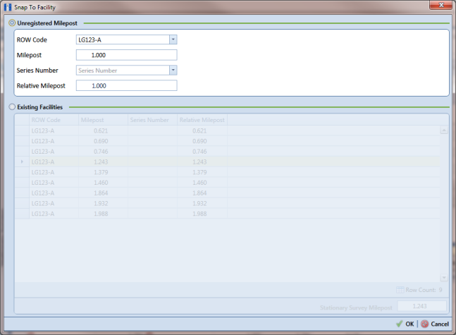
Match a Stationary Survey to an Existing Milepost Location
When a stationary survey includes milepost locations that do not match existing milepost locations already established in PCS Axis, these mileposts are identified as Unregistered Milepost. Unregistered mileposts relate only to the associated stationary survey and are not considered as facilities in PCS Axis.
To ensure telluric compensation calculations are accurate, use
Snap To Facility to match milepost locations in a stationary survey to existing milepost locations already established in PCS Axis (
Figure 14-13).
To match milepost locations in a stationary survey to existing milepost locations in PCS Axis, follow these steps:
1 Select the pipeline segment(s) you want to work with in the
Select ROWs window (
Figure 14-2).
2 Click Data Entry > Stationary Survey Maintenance to open the Stationary Survey Maintenance window.
3 Click the down arrow in the
Date range field and select an option in the selection list to filter the data view in the
Stationary Surveys grid. Then click
 Refresh.
 4 Select a stationary survey in the
Stationary Surveys grid and then click the
 Snap To Facility
 button to open the
Snap To Facility window (
Figure 14-13).
Figure 14-13. Snap To Facility
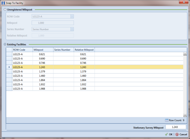
5 Click Existing Facilities to enable the grid for use.
PCS Axis automatically selects the closest existing milepost location as indicated by the highlighted record labeled
LG123-A, 1.243 shown in the following example (
Figure 14-14). You can however change the selection if needed.
6 To snap the stationary survey to an existing milepost location, select a milepost record in the grid and then click
 OK
OK.
7 When the
Snap To Facility window closes, click
 Save
Save in the
Stationary Survey Maintenance window to save changes.
Figure 14-14. Snap To Facility